I'm running ver 2.51 beta.
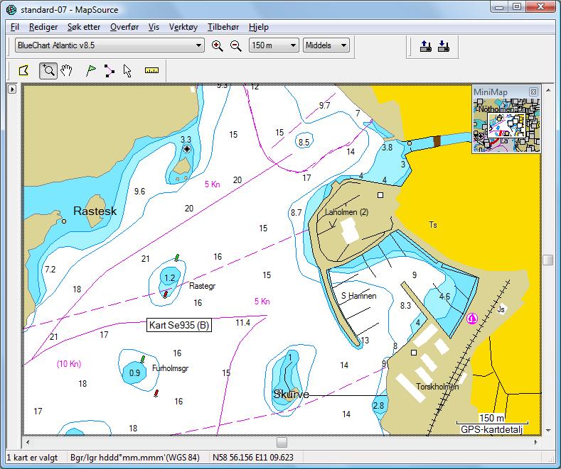
I'm using Chart Se 935(B) Sweden, and the position is near
N 58° 56.156' E011° 09.623'
BlueChart 7.0 shows this image of the area, and it's correct.
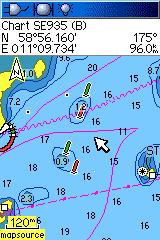
| Garmin 60CS | Colorado 300 |
 |
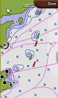 |
Garmin 60CS shows the obstructionss correct relative to the buoys. If you use the Colorrado you will probably steer on the wrong side of the green buoy. This may be a fatal error.
Copyright © Otto Milvang